The Global Airborne Observatory lands at ASU

Frame grabs from the new GAO WingCams while it maps reefs off Maui, Hawaii. Photo credit: Greg Asner, 2020
The Global Airborne Observatory, formerly the Carnegie Airborne Observatory, has a new home at Arizona State University’s Center for Global Discovery and Conservation Science, under the direction of Greg Asner.
High tech airborne mapping technology
Developed by Asner and his team, the observatory is an airborne laboratory that houses the most advanced Earth-mapping technology. The original version of the airborne observatory was launched in 2006 and has since undergone enormous improvements in both the aircraft and its instrumentation and computing package, called AToMS, or Airborne Taxonomic Mapping System.
AToMS is now in its fourth generation, with advances in all sensors. AToMS has four integrated mapping technologies: high fidelity visible-shortwave infrared (VSWIR) imaging spectrometer; dual-laser, waveform light detection and ranging (wLiDAR) scanner; high-resolution visible-to-near infrared (VNIR) imaging spectrometer; and high-resolution digital imaging camera. The VSWIR and VNIR sensors measure the reflectance of the Earth’s surface in hundreds of spectral channels from the ultraviolet to the visible, near-infrared, and shortwave infrared to provide measurements of chemicals in the environment, such as in tree canopies and corals. The wLiDAR sensor fires two laser beams out of the bottom of the GAO that sweep back and forth during flight, imaging the 3D structure of vegetation including leaves and branches, and all the way to the ground.
AToMS collects data about the structural, taxonomic, and chemical makeup of ecosystems and is able to map features on the Earth’s surface in three dimensions, including all terrestrial ecosystems and human-built environments. AToMS can also image coral reefs and other aquatic habitats with spectral detail.
The Global Airborne Observatory is also now carbon-neutral through Arizona State University’s Carbon Project, a program that helps the Center for Global Discovery and Conservation Science to acquire offsets equivalent to the observatory's airborne emissions, helping to reduce the aircraft’s carbon footprint.

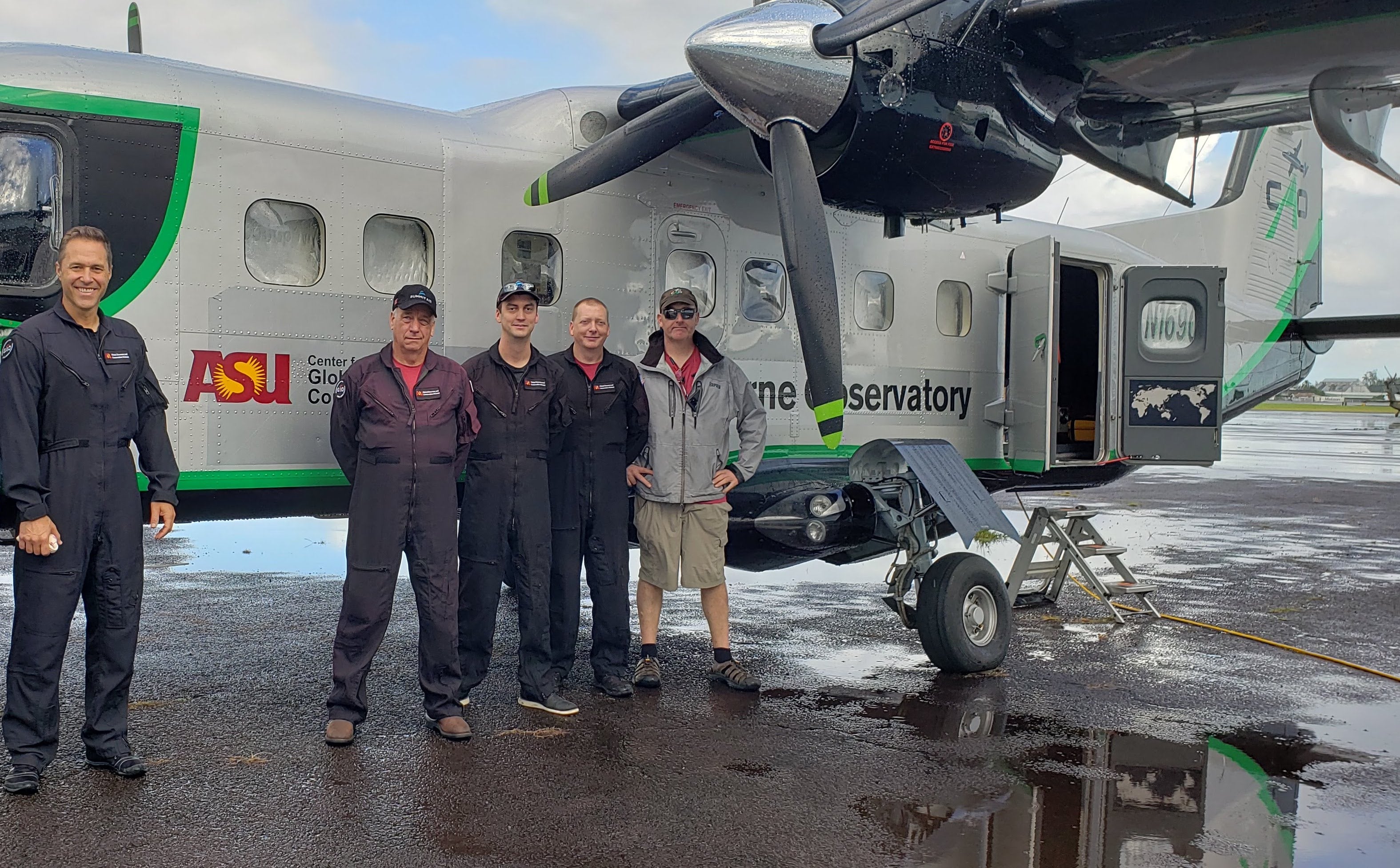
Center for Global Discovery and Conservation Science Director Greg Asner (far left) with the GAO crew (from left to right: Don Koopmans, Devon Woodward, Joseph Heckler and Sheldon DeCosse) in Hilo, Hawaii.
A pathfinder to new discoveries
The Global Airborne Observatory has been deployed to nearly every type of ecosystem — from coral reefs to savannas and deserts to rainforests —and in 11 countries. Maps and data from the observatory have been used to make numerous fundamental discoveries including the makeup and functioning of ecosystems, the effects of human activities on forest biodiversity and carbon stocks, and the impacts of climate change on land and ocean environments.
Yet the Global Airborne Observatory program’s biggest impacts center on concrete decision-making at a range of scales, from local communities to international governing bodies. New protected areas on land and in the sea have been established based on observatory data, regulatory emissions planning and enforcement have been undertaken via observatory mapping, and a wide range of environmental interventions have been steered by observatory results. Asner describes the Global Airborne Observatory program as a “pathfinder at times, and an exposé machine at other times.”
Ambitious plans for 2020
The observatory's mission has recently expanded due to a new collaboration with the University of Arizona and the Jet Propulsion Laboratory. This mission will focus on mapping industrial and agricultural methane and carbon dioxide emissions in the United States.
Observatory scientists are also working with Hawaii’s Department of Land and Natural Resources to map the health of reefs along more than 700 miles of shoreline in the main Hawaiian Islands following the 2019 coral reef bleaching event.
“Our airborne observatory has unique capabilities that allow us to see through seawater to a depth of 70 feet. What we want to see is where there’s live coral on the seafloor, where there’s dead coral, where there’s algae, the depth of the water, and 3D imaging of fish habitat,” Asner said.
The outcome of these airborne surveys will be used to inform the development of new marine management across the Hawaiian Islands.
Given the paucity of high-tech, direct-action remote sensing data available from other sources, the Global Airborne Observatory program is growing to include collaborators and clientele spanning any terrestrial or coastal ocean ecosystem worldwide.
More Science and technology

Stuck at the airport and we love it #not
Airports don’t bring out the best in people.Ten years ago, Ashwin Rajadesingan was traveling and had that thought. Today, he is…

ASU in position to accelerate collaboration between space, semiconductor industries
More than 200 academic, business and government leaders in the space industry converged in Tempe March 19–20 for the third annual…

A spectacular celestial event: Nova explosion in Northern Crown constellation expected within 18 months
Within the next year to 18 months, stargazers around the world will witness a dazzling celestial event as a “new” star appears in…

