Map explorer tool recognized at world's largest GIS conference

From left to right: Eric Friesenhahn, Jill Sherwood and Matthew Toro in the Map and Geospatial Hub with the Esri Special Achievement in GIS Award.
Looking for a map but can’t make it to the library? Look no further than your PC or smartphone.
The ASU Library Map and Geospatial Hub’s virtual 3D Explorer application opens the doors of the hub to users all over the world, with the ability to experience the space and browse the collection virtually.
Recently, the innovative tool received special recognition from leading industry experts at the 2022 Esri User Conference, where the Map and Geospatial Hub's 3D GIS Explorer project was honored with the Special Achievement in GIS (SAG) Award.
This is the first time Arizona State University has been awarded an Esri SAG award, which honors organizations for their vision, leadership and innovative use of geographic information systems (GIS).
At the worldwide conference held July 11–15 in San Diego, Matthew Toro, director of maps, imagery and geospatial services, accepted the award on behalf of his team.
“It’s an honor to receive a SAG award from Esri,” Toro said. “Beyond the simple recognition of our work, the award also validates the grand vision we’ve been working on for the last several years at ASU Library: utilizing cutting-edge GIS technologies to introduce new workflows and ways of thinking about map and GIS librarianship for the 21st century and beyond.”
The Environmental Systems Research Institute, Inc., known as Esri, provides digital mapping and analytics software known as ArcGIS. Established in 1969 by Jack Dangermond and Laura Dangermond, the company created software used by millions of people around the world for geographic planning and environmental science.
Welcoming people virtually from all over the world
Launched in 2021, the 3D Explorer application allows library users anywhere in the world to visit the Map and Geospatial Hub. The application’s customized software relies on multiple Esri software components. The ASU Library’s map collection consists of maps, aerial photographs and other geographic information resources. Users can virtually explore the materials and unique features found within the library space.
Eric Friesenhahn, map and GIS specialist at the ASU Library, has worked on the project for over two years. He explained how the application has improved workflows at the Map and Geospatial Hub: “The 3D Explorer makes it significantly easier to find items in our extensive collection of nearly 80,000 maps,” Friesenhahn said.
“It's no longer necessary to find the physical item to see what it looks like, allowing us to serve library patrons more efficiently. Reactions have been incredibly positive, and we’re all very excited for what the future of this app holds,” he said.
Making the library more accessible
The 3D Explorer revolutionized the way the Map and Geospatial Hub has been able to serve the ASU and broader community, especially during the pandemic. With students and researchers working remotely, the technology allows every user to have the experience of browsing the collection as if they were in person.
Bob Cowling, Map and Geospatial Hub intern
Even members of the Map and Geospatial Hub team were able to work remotely on this project, meeting over Zoom to improve the user experience.
Bob Cowling, a GIS data librarian at Michigan Technological University, was the team’s first fully remote intern.
“What I find fascinating about the 3D Explorer application is that it allows for the discovery of items in library collections in an engaging and interactive way,” Cowling said. “Often, patrons will search the library catalog for maps and atlases, but with the 3D Explorer, not only do they receive search results, but they also get to visually see where the item is located in the library and a thumbnail of the actual scanned map image.”
Among more than 100,000 organizations, ASU stood out for its outstanding work with GIS technology in developing the 3D Explorer application. The virtual map gallery at the conference featured the application for online attendees to explore.
What’s next for the 3D Explorer?
The 3D Explorer will continue to evolve and undergo regular enhancements, and the team is considering new possibilities for the next phases of the application.
For Jill Sherwood, geospatial data analyst with the ASU Library, she looks forward to increasing interactive features.
“It was exciting to see the project progress from the original 3D prototype back then to what it is now. As our available digital cartographic resources grow, we will look at ways to improve on the functionality of the 3D Explorer,” she said.
With tens of thousands of maps and resources in the collection, Toro and his team still have a lot of work ahead.
“First things first: We need to get 100% of our geographic information assets digitized and fully loaded into the 3D Explorer,” Toro said. “Then we can start seriously exploring the very viable possibilities of taking the project to the next level by integrating it with virtual reality, mixed reality or augmented reality technologies.”
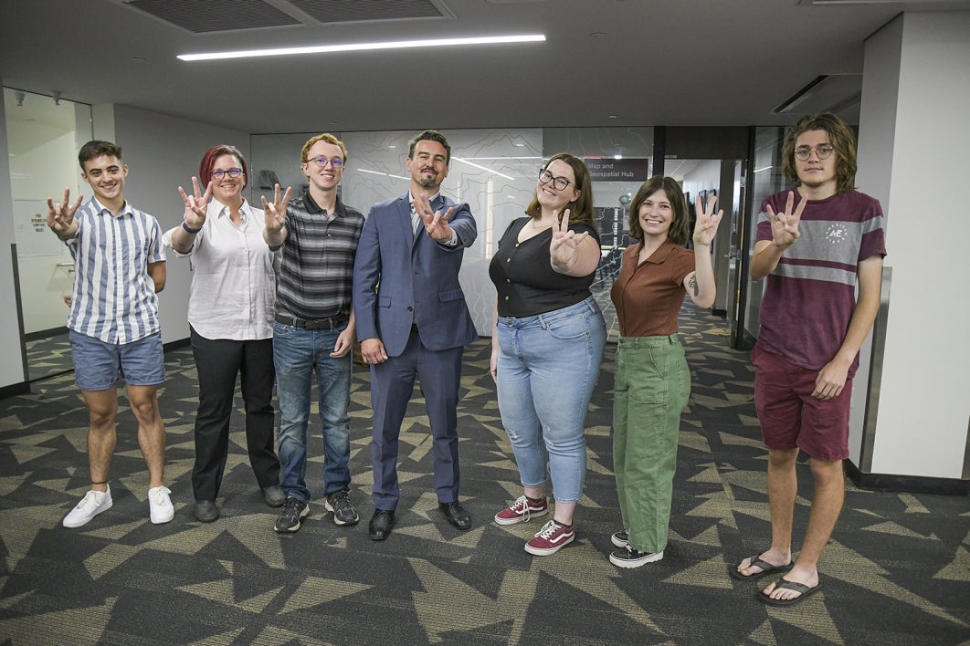
The Map and Geospatial Hub team from left to right: Giovanni Catanzaro, Jill Sherwood, Eric Friesenhahn, Matthew Toro, Kelsey Kerley, Paityn Schlosser and Grant Bahen. (Catanzaro, Kerley, Schlosser and Bahen are map and GIS assistants). Photo courtesy ASU Library
More Science and technology

ASU-led space telescope is ready to fly
The Star Planet Activity Research CubeSat, or SPARCS, a small space telescope that will monitor the flares and sunspot activity…

ASU at the heart of the state's revitalized microelectronics industry
A stronger local economy, more reliable technology, and a future where our computers and devices do the impossible: that’s the…

Breakthrough copper alloy achieves unprecedented high-temperature performance
A team of researchers from Arizona State University, the U.S. Army Research Laboratory, Lehigh University and Louisiana State…


