Disturbing news came out of Mexico City over the past few weeks. In some places the megalopolis is sinking as much as a foot and a half annually. Some areas could sink as far as 65 feet in the next 150 years.
It is the fastest sinking city in the world.
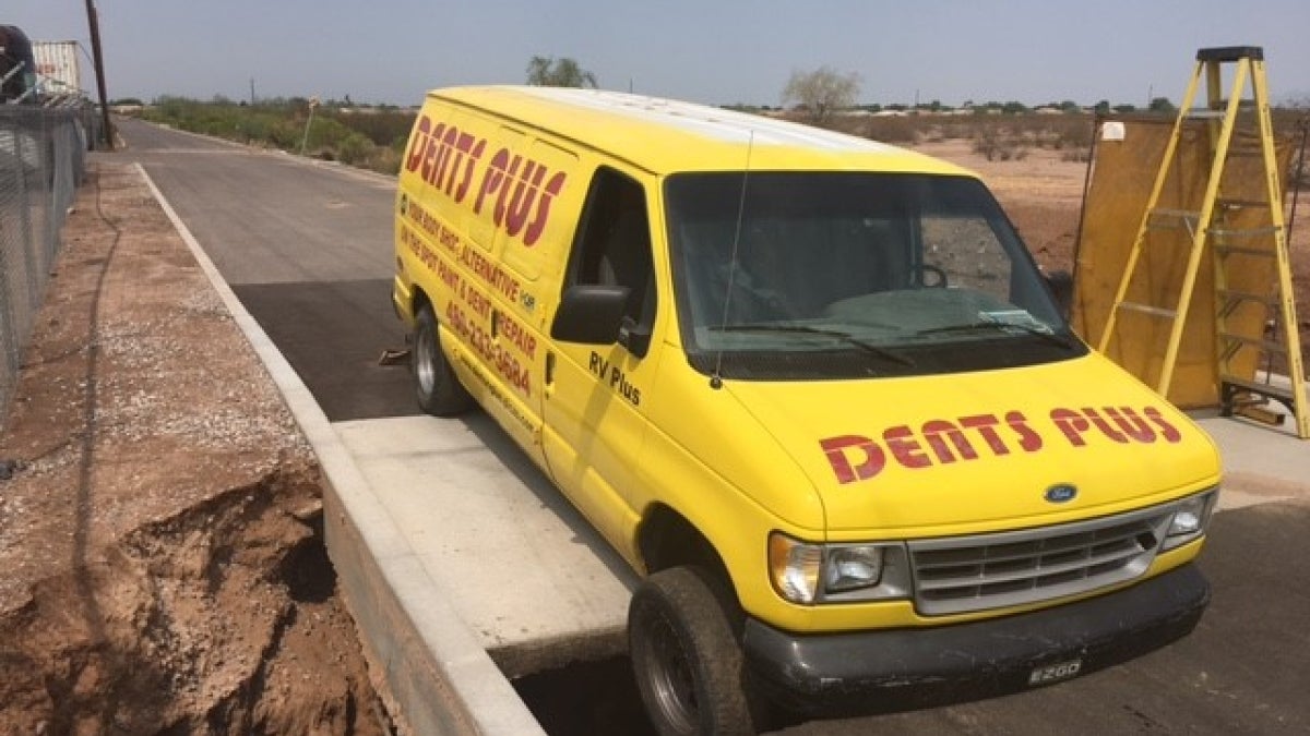
And the same geological phenomenon is happening in metro Phoenix, according to researchers at Arizona State University and the state government. In extreme cases, cars and a horse have been swallowed by the cracks it creates.
“(Many) aquifers hold water in between the core space of a sediment,” she said. “When you remove that water, sometimes those sediments rearrange, and that core pressure that was keeping the grains apart has collapsed. And so over time that causes the ground surface elevation to lower because basically the space in between the grains has been removed.”
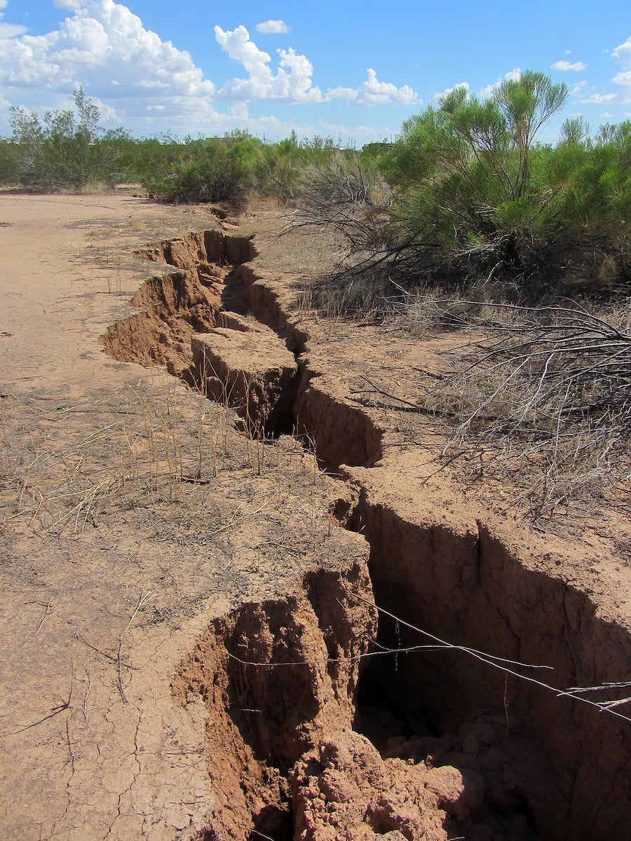
When the ground sinks, fissures erupt. The desert Southwest is mostly basin and range topography. Drive to Palm Springs, California, or Tucson and you’ll have a perfect illustration of it: wide, deep alluvial basins interspersed with solid bedrock mountains. When you draw down water in these basins, the land surface sinks and gets torn apart from the bedrock.
Earth fissure in the metro Phoenix area.
On the night of July 21, 2007, a thunderstorm pounded Chandler Heights with 2 inches of rain in an hour. A fissure opened up from just north of the San Tan Mountains, crossed the Hunt Highway and San Tan Boulevard, curved west and stopped just short of Sossaman Road. It wasn’t new. It was visible on aerial photos back in 1969. When Chandler Heights was developed, the fissure was backfilled in places. When the rain hit it, water flowed in and undermined the backfill. The crack widened.
When the backfill collapsed, a hole was left more than 40 feet deep in places and 15 feet wide in others. Corral fences collapsed. In a Chandler Heights paddock, a 13-year-old, 1,110-pound horse named Cash fell in the fissure as the earth collapsed beneath him. After a 15-hour rescue attempt, Cash died.
The fissure had been backfilled after an August 2005 storm. That event drove the state Legislature to require that fissures be disclosed in real estate transactions and tasked the Arizona Geological Survey to map them.
Backfilling — with earth, riprap, tires or whatever — doesn’t work, said hydrologist Brian Conway, supervisor of the Geophysics-Surveying Unit for the Arizona Department of Water Resources.
“We kind of have a joke in the science world that you don't know if it's an earth fissure until there's tires in it,” Conway said. “The tires will just stay there, but the finer grain material like soil and stuff like that, you try to fill it up with dirt and everything. But you want to keep water away from it 'cause that hairline crack is going to always be there. And so when you have rain and runoff, that water is going to infiltrate, get through that dirt that's put in there and slowly erode it down into that crack. And it's going to open back up again due to the erosion.”
The town of Queen Creek has filled in the fissure that swallowed Cash, and it hasn’t opened up since.
“I have noticed when I've been out there that the way the water drains to their area is a little bit different than what it used to be,” Conway said.
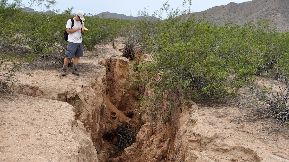
A scientist studies an earth fissure in the greater Phoenix area.
There are three subsidence areas in metro Phoenix, according to Conway. There’s a big one called the West Valley Feature around Luke Air Force Base. Between 1957 and 1992, geologists had measured 18 feet of subsidence by the base. It has slowed down dramatically, to where it's only maybe an inch or two a year.
Another spot in the northeast Phoenix-Scottsdale area subsided about 5 feet by the early '90s as well. It has also slowed dramatically.
Finally, there's the Hawk Rock area, which is in the East Valley near the east Mesa and Apache Junction border with U.S. 60, and south a little bit toward Gateway Airport. That area had subsided about 5 feet by the late '80s. Now it's only subsiding about 2 to 3 centimeters a year.
Subsidence has slowed mainly because agriculture has been supplanted by housing. Farmers aren’t pumping groundwater for irrigation. Water use has declined and become more efficient as the population has increased.
While the law requires fissures be disclosed in real estate deals, “a lot of times people just don't read all of the fine print,” Carlson said. “And so they don't know that they're purchasing a home in an area that is prone to fissures. Something that I would recommend is the Arizona Department of Water Resources has maps of subsidence features that they get from something called interferometric synthetic aperture radar, which is a satellite that is used to help see where places are deforming. They have maps publicly available. And so if you look at places that are subsiding, just stay away from that area.”
On a grand scale, not much can be done about subsidence once it’s under way. It’s a regional problem.
“You're talking hundreds of square miles, some of these features,” Conway said. “There really isn't anything you can do. And it's not like it's dropping catastrophically fast. It's very slow.”
Photos courtesy of Arizona Department of Water Resources/Brian Conway
More Environment and sustainability

Mapping DNA of over 1 million species could lead to new medicines, other solutions to human problems
Valuable secrets await discovery in the DNA of Earth’s millions of species, most of them only sketchily understood. Waiting to be revealed in the diversity of life’s genetic material are targets for…

From road coatings to a sweating manikin, these ASU research projects are helping Arizonans keep their cool
The heat isn’t going away. And neither are sprawling desert cities like the metro Phoenix area.With new summer records being set nearly every year — 2024 was the warmest year on record for…

New study on Arctic’s ‘Last Ice Area’ highlights the urgency for reducing warming
The Arctic’s “Last Ice Area” — a vital habitat for ice-dependent species — might disappear within a decade after the central Arctic Ocean becomes ice-free during summer, which is expected…


